

“Life is not measured by the number of breaths we take, but by the moments that take our breath away.”_ Hillary Cooper
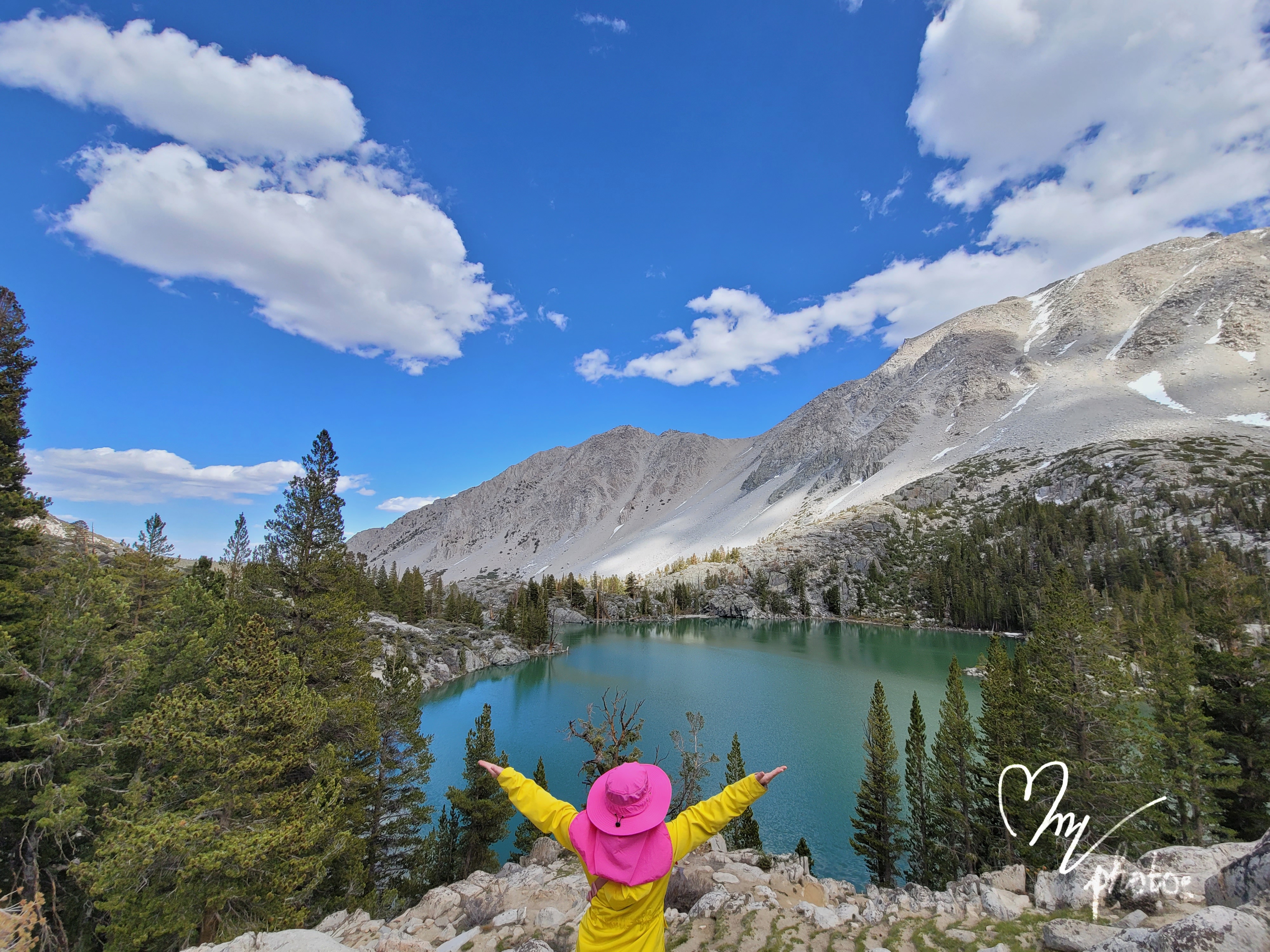
It has been a while since we get out of the house and explore. I still have not got over the fact that we have such a mesmerizing scenery in California. This is one of the most beautiful lake I’ve ever since.
We did 3 days 2 night camping/hiking for this trip from Los Angeles to Big Pine.
First stop is Musical road. I recommend to drive at least 30mph to able to hear the melody. It’s a section of a road, which when driven over causes a tactile vibration and audible rumbling that can be felt through the wheels and body of the vehicle. This rumbling is heard within the car as well as the surrounding area, in the form of a musical tune.
Nearby, there’s a airfield you can stop by as well.

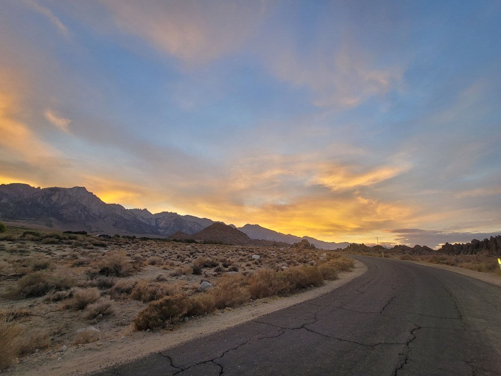
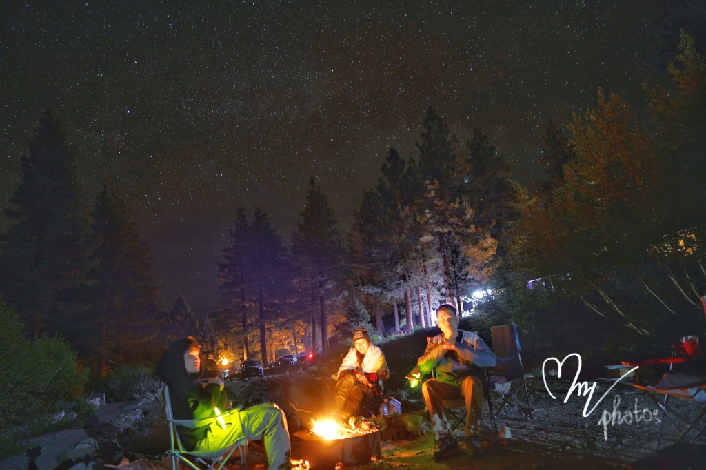
The rest stop for the first night is at Alabama hills in Lone Pine. We got there just in time for sunset. We drove around to pick a good spot for our tents. It’s free but you got to follow the leave-no-trace rules.
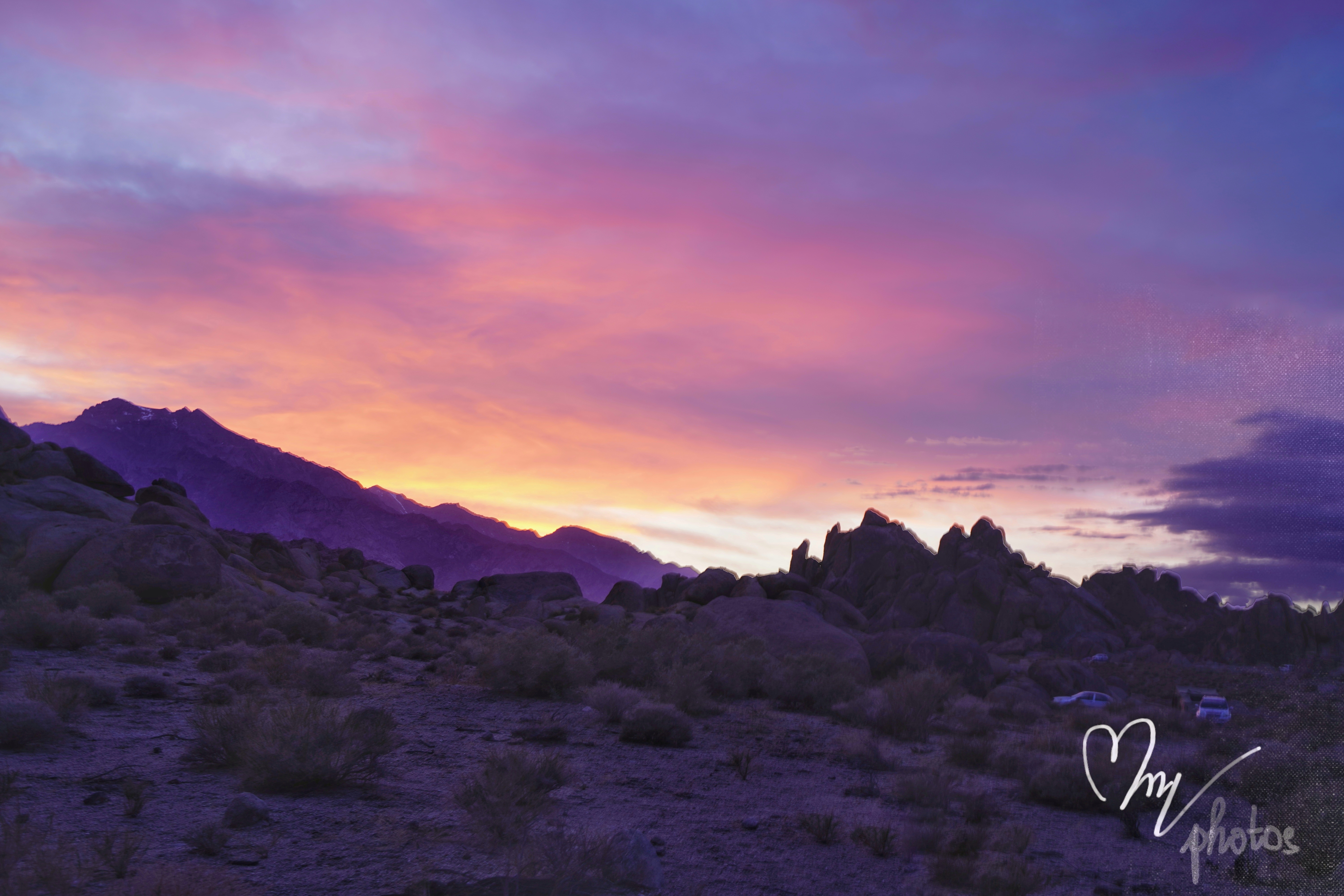
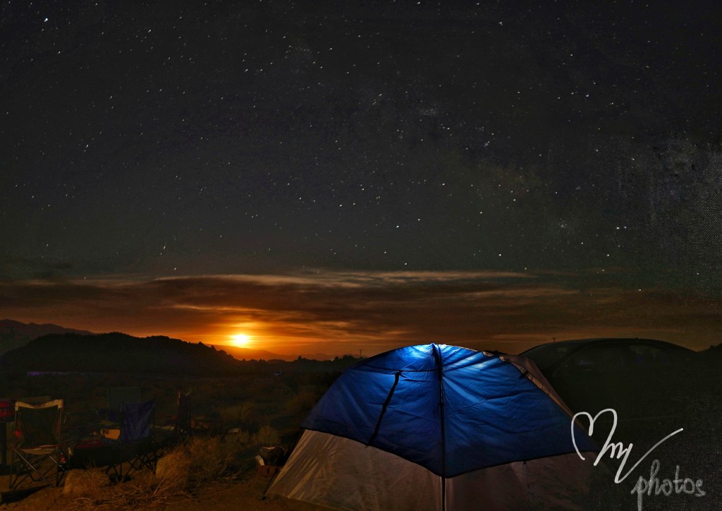
Stars gazing is perfect here. When we were about to call it a night, we encountered the most mesmerizing view of the sun rising.
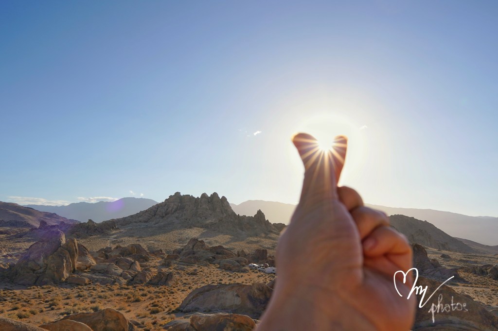
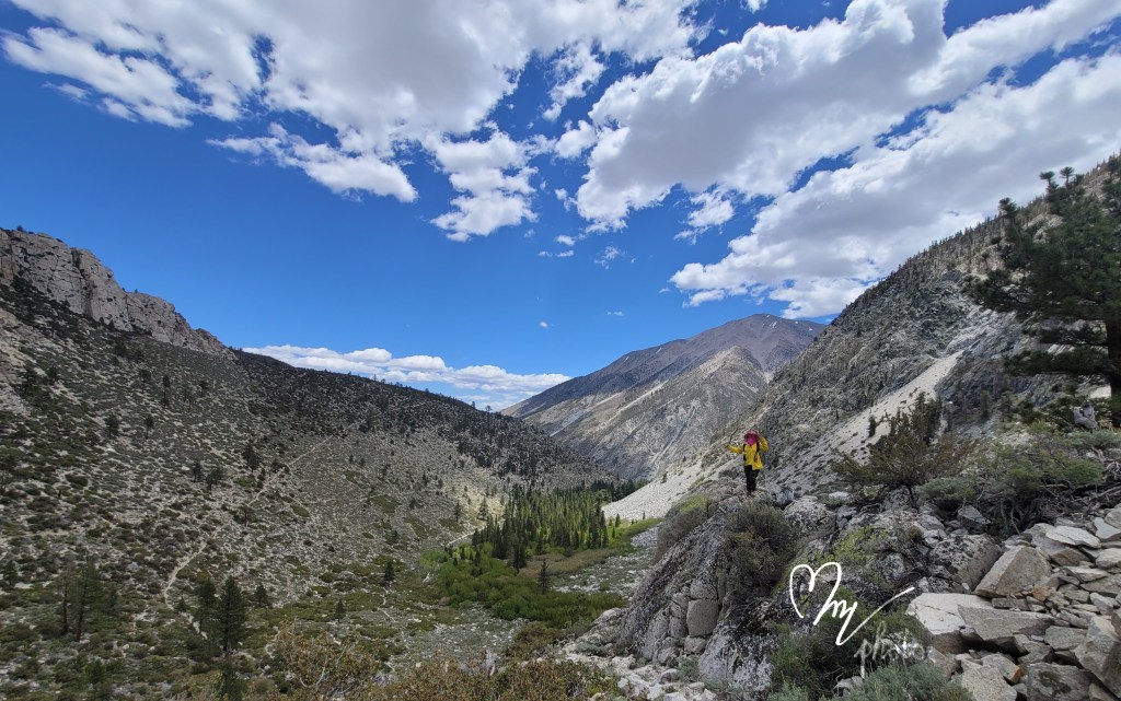
We started the 2nd day with a little hike to the Eye of Alabama hills.
The highlight of this trip is at Big Pine lakes. The trailhead starts at Big Pine Creek campground. There’s total seven lakes in this part of Indyo Park, through North Fork trail. It’s roughly over 5 miles uphill with steep incline to get to the first lake. As for day hike, it’s recommended to turn around at 3nd lake. If you want to complete do the whole seven lakes, you need to camp overnight in between 2nd and 3rd lake. Overnight camping will require permit which can obtain from recreation.gov website, 6 months in advance.
Here is the link https://www.recreation.gov/camping/campgrounds/232305
Directions And GPS Tracks:
- The trailhead to hike the Big Pine Lakes Trail begins at the Big Pine Creek Campground. Click here for directions.
- Take HWY 395 to the city of Big Pine, CA, which is located just south of Bishop, CA. From Big Pine, head West on W Crocker Ave. W Crocker Ave will become Glacier Lodge Rd. Stay on Glacier Lodge Rd until you reach the trailhead.

Key Points:
- Distance: 11 miles ( to Second Lake)
- Elevation Gain: 2848 ft
- Minimum Elevation: 7814 ft
- Maximum Elevation: 10,291 ft
- Time: 6-10 hours
- Difficulty: (4/5)
- Dog Friendly: Yes
- Permit Required: Not for hiking, but a permit is required for backpacking overnight.
- Parking: There is a small parking lot at the trailhead that fills up pretty quickly on summer weekends. There is an overflow lot nearby and parking along the street as well.
- Trail Condition: This is a steep and rocky trail. There are a few creek crossings that can run pretty high depending on the season. The first half of this trail is fully exposed and can be very hot in the summer.
- Cell Phone Reception: None.


It took us over 5 hours to get to the Second lake but only 1.5 hours to get back to our cars.. We were lucky enough to get a camping spot at Big Pine Creek campground after long strenuous hike. It has the trout pond view and light from the visitor center without sharing with anyone.

On our way back, we stopped at Red Rock Canyon. It was 102⁰C at that time so we could not explore much.

It’s successful trip considering our limit timeoff. I cannot send enough thanks to my camping buddies, despite our limited experience in the wild, we did handle it very well. I’m looking forward to our next adventures.


Leave a comment